A World of Maps!
Teacher
Page
A WebQuest for 3rd Grade Social Studies/Geography
Designed by
Jolette Bernhardt
bern4898@pacificu.edu
http://education.ed.pacificu.edu/sweb/jbernhardt
Introduction
| Learners
| Standards
| Process
| Resources
| Evaluation
| Conclusion
| Credits
| Student
Page
Introduction
This WebQuest was developed as a means for students to gain information and view the various types of maps society uses on a daily basis. Whether it is checking the morning weather report, planning the daily commute to school or work, mapping out a family vacation, participating in a scavenger hunt or just inquiring information about the world around us, maps are a useful and necessary tool for all societies and can be a powerful tool to see the world.
In this WebQuest students will be challenged to learn about the main types of maps society uses, observe their individual characteristics, what each is used for and their strengths and weaknesses. It is also an opportunity for students to compare the different types of maps to one another. The design of the WebQuest encourages cooperative learning as each pair of students will become experts on a specific type of map and share their findings with the class.
Learners
This lesson is designed for 3rd grade social studies/geography. It is assumed that students have some background knowledge of maps and their uses. Ideally, this WebQuest should be used an extension to a study of maps. It can also be used as a means of assessment of an accumulation of knowledge.
Objectives and Curriculum Standards
Objectives
1. During this lesson, students will be able to demonstrate their understanding of the various purposes and features of maps by identifying the characteristics and uses of maps on their note sheets.
2. During this lesson, students will be able to demonstrate their ability to analyze the strengths and weaknesses of different types of maps by listing what the maps do and do not show on a chart (in pairs and with the class).
3. At the culmination of this lesson, students will be able to apply their understanding of the characteristics of maps by creating their own representation of a map including main features and details.
Social Studies Content Standards Addressed:
1. Compare and analyze physical (e.g. landforms, vegetation, wild life, climate and natural hazards) and human (e.g. population, land use, language, and religion) characteristics of places and regions.
2. Locate major physical and human features of the earth.
3. Locate places and understand and use geographic information or relationships by reading, interpreting and preparing maps and other geographic representations.
*Standards taken from the state of Oregon 2004 social studies content standards
Process
1. First, the teacher or students will choose a partner to work with on the investigation. (If teacher chooses, he/she should consider language and technological skills of the students.)
2. Once the students have their partner they can begin the investigation on the provided websites. Students should take notes on the provided note sheet making sure to address each question.
3. After the initial research each pair will choose a type of map to analyze more deeply (or the teacher can assign certain maps to pairs to ensure all the map types are covered). The pairs of students will revisit the appropriate web pages and create a list of strengths and weaknesses for their chosen map. They will also note what the uses of this type of map might be.
4. After the students note the strengths and weaknesses of their chosen type of map they will brainstorm, plan and then create their own map that reflects the features of their chosen type of map. (The teacher may decide if the maps should reflect an actual existing place or if the maps can be made up.)
6. Finally, all pairs will share their findings of the characteristics, strengths and weaknesses and the created maps with the rest of the class. (Optional: The class can note the characteristics and strengths and weaknesses of each type of map on large chart paper.)
Organization
This WebQuest should take about two to three 45-60 minute blocks depending on the time and effort the teacher wants to students to put into their map making. It is recommended that students do their initial research on the overview of the types of maps and view the images during the first session. By the end of the first session teachers should advise the students to decide which map they are going to focus on and begin analyzing the strengths and weaknesses of their chosen maps. During the second session, students should begin to brainstorm how they are going to create their map and begin their creation. The third session (if used) should be used to finish and share their maps (and create a class chart if wanted).
This WebQuest is useable for any teacher. I have included an evaluation rubric to assess the students’ work towards to objectives previously stated. Teachers need minimal technological skill to teach this WebQuest. The teacher needs only basic Internet navigation skills to assist the students in their investigation.
Variations
If your school does not have a computer lab and/or you do not have access to computers in the classroom it is feasible to print out the information pages and maps to disperse as hardcopies to the students.
Resources
Needed
1. Access to a school computer lab or a computer for each pair of students.
2. Internet access on each computer
3. Note sheet for each pair of students.
4. Large chart paper for class recording
5. Materials to make a model of the chosen type of map.
6. Volunteer(s) may be helpful but not necessary in managing and helping students navigate the web.
Evaluation
Authentic assessment should be used in the evaluation of the students. Teachers should focus on observing students while they work and discuss with their partner. In addition, teachers should review the note sheet for each pair, their final created map and their presentation of their findings from their investigation. Assessment should be made on quality, accuracy and effort. I have included an evaluation rubric that can be used to evaluate each student/pair of students.
|
A World of Maps WebQuest
|
Beginning
1
|
Developing
2
|
Accomplished
3
|
Exemplary
4
|
|
Overall Task Completion
|
Student does not complete the WebQuest. Work shows little or no effort and there are entire portions of the assignment missing.
|
Student completes most of the WebQuest, although the work shows developing skills or minimal effort. There may be portions of the assignment missing.
|
Student completes all portions of the WebQuest. Work shows care and thought.
|
Student completes all portions of the WebQuest with care. Work shows outstanding effort and student did work beyond the requirements.
|
|
Completion and Accuracy of Research
|
Student may or may not research his map. Questions are not answered fully or accurately. |
Student researches his/her map with minimal effort. He/she may not answer all the questions on the note sheet or may answer questions incompletely.. |
Student thoroughly researches his/her map. He/she answers all the questions on the note sheet with care. |
Student thoroughly researches his/her map. He/she answers all the questions on the note sheet in detail and includes extra information. |
|
Analysis of map characteristics
|
Student may or may not analyze their characteristics of their chosen map. Their notes do not reflect the assignment given, show lack of effort or fail to show strengths and weaknesses of their map |
Student barely completes the assignment. The analysis may be inaccurate or made up. |
Student analyzes their map. He/she integrates information from his/her research into his/her analysis. |
Student creates an analysis with exemplary effort. It is obvious thought and care have been included Details are present. |
|
Ability to Work With a Partner
|
Student does not work well with partner. He may or may not try to get involved and refuses to compromise or problem solve when he is involved. |
Student works with partner, but compromise and decision-making may be difficult. Student may attempt to problem solve unsuccessfully. |
Student works well with partner. He/she expresses needs and opinions to other members of the group and problem solves when necessary. |
Student works exceptionally well with partner. He/she respectfully expresses needs and opinions. He/she problem solves with partner. |
|
Map Making Effort and Authenticity
|
Student may or may not create a map. The map does not reflect the assignment given, show lack of effort or fail to show characteristics of the map. |
Student barely completes the assignment. The characteristics may be inaccurate or made up. |
Student creates a map. He/she integrates information from his/her research into his/her map. |
Student creates a map with exemplary effort. He/she uses creativity and care in creating the map. Details are used in the map. |
Conclusion
This WebQuest encouraged students to work cooperatively with his or her peer to investigate a specific type of map. They then created an example of this type of map using what they learned through their research. Students got to teach the class about their map and all students got to learn about the other types of maps by listening to their peers' presentation. I hope that this was a rich experience for the students and they were able to take ownership in their analysis and what they created.
Credits
& References
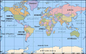
The image of the map is from: http://www.worldpress.org/images/maps/world_600w.jpg
back to homepage
Last
updated on August 15, 1999.
Based
on a template from The
WebQuest Page
|