Journey Down the Mississippi
A WebQuest for 5th Grade Social Studies
Designed by Noelani Gurske
Introduction | Task | Process | Evaluation | Conclusion | Credits | Teacher Page
Introduction
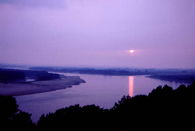
How would you like to take a trip down the Mississippi River? Would you know which states to stop at along the way? How would you decide which states to stop at? What would you do once you stopped at a state?All of these questions could be answered if you had a guide book to the states along the Mississippi River.Task
As a class, we will be creating a travel guide to lead people through the states that border the Mississippi River. You will be divided into teams of three or four, and each group will be assigned to a state. Your team will need to create an interesting and attractive page, featuring your state and the cities you choose to research from that state. You will need to describe the important features of the land, wild life, and history of those places. After creating your portion of the guide, you will present it to the class, and a book will be made of all ten states that are on the Mississippi River.Process
Mississippi River Wisconsin Minnesota Iowa Illinois Missouri1 2 3 4 5 6 7 1 2 3 1 2 3 1 2 3 1 2 1 2
Kentucky Arkansas Tennessee Louisiana Mississippi
1 2 1 2 1 2 1 2 1 2
- Explore the links provided about the Mississippi River to get a general idea of what the guide will be about.
- The class will be split up into groups of three and each group will be assigned a state.
- As a group, find out which towns and cities of your state
are located along the Mississippi River and choose three to focus on.
- One person in each group is responsible for sketching an
outline of their state, and add in physical
(where the Mississippi River is located, other rivers, mountains, etc.)
and political (cities) features. Be sure to add in the cities along the
river that your group is doing further research on.
- One person in each group is to find out what cities are
along the river banks of their state, and find three things that can be
done while in those cities. Also, report on the common wild life and
plant life of the area around your town.
- One person in each group is to research the history of the
three chosen towns, and how the Mississippi River is connected with the
history and lifestyle of the people that live in that town. Also
include some information about the people in the town.
- Make sure you share all of the information you have found
with each other and that everyone in the group agrees with the
information. Be sure to help each other to get all of the components of
your state completed.
- Put your map and all of your information on two pieces of 8.5 x 11 paper, along with illustrations and the name of your state. Neatness counts, as you want to convince people to come to the cities in your state.
- Groups will present their state to the rest of the class,
and then the completed pages will be compiled into a class book.
Evaluation
You will be evaluated on your portion of the group work as a
whole group, and as an individual. Below is the scoring rubric that
will be use to evaluate the group work. Your individual score will be
based on the two scores that the group gets for the components of your
section (ex: if your job is to create the map, you will be given the
score the group receives on the sections of 'Physical Components of
Map' and 'Political Components of Map.'
|
Beginning 1 |
Developing 3 |
Exemplary 5 |
Score |
|
|---|---|---|---|---|
|
Creativity of Guide Page
|
Identifies state
and points with little color or excitement. |
Includes some
sketches and some color, but still lacks some appeal. |
Has rich color
and/or detailed drawings with borders or other elements that add appeal. |
|
Neatness & Accuracy |
Legiblility,
spelling and grammatical errors causes some difficulty to the reader. |
Legibility
is fairly neat, but still includes a few spelling and grammatical
errors. |
Legibility adds to the page. No spelling or grammatical errors. |
|
|
Physical Components of Map
|
Includes an
outline of the state map and the Mississippi River may be included. |
Includes a sketch
of the map with the Mississippi River, and one or two physical
features labeled. |
Includes a
detailed drawing of the state map and includes the Mississippi River,
and at least 3 physical features. |
|
Political Components of Map |
Less
then 3 cities are labeled on the map. |
Three
cities are labeled on the map and bordering states are labeled. |
Includes
at least 3
cities, including the capital city, bordering states, a key and a
compass rose. |
|
|
Cities |
Cities that fall
on the Mississippi River are listed. |
Less than three
cities that fall on the Mississippi River are listed and described with
2 details each. |
At least three
cities that fall on the Mississippi River are listed and described with
more than 3 facts each, and include how the Mississippi is important to
that city. |
|
Wildlife/ Plant life |
There are less than two species listed for each category. | Three to four species in each category are listed, and described. | At least five species in each category are listed, described and drawn. | |
|
History
|
Less than two
historical facts are given about your state. |
Three to five
historical facts are given about your state, and include the dates. |
More than five
historical facts are given about your state, and include the dates.
Famous people from your state are also included. |
|
|
Lifestyle
|
Few facts are
given about the towns and no connection is made between the town and
Mississippi River. |
At least 2 facts
are given about the people that live in each town, but little or no
connection is made between the town and the Mississippi River. |
At least two ways
in which the town is connected to the Mississippi River are stated, and
at least 3 facts about the people who live in each town. |
Conclusion
This webquest has guided you through a research project as a
class, and together, you have compiled a guide to places along
the Mississippi River. You have learned how important the Mississippi
River is to these cities and states, and how greatly all of these
places vary, but are tied together by this famous river.
There are other famous rivers in the United States and around
the world. How do people use and depend on these rivers? How would the
lives of these people change or be different if these rivers flooded?
Dried up? Or did not exist at all? Take a look at some of these links,
and see if these rivers share any of the same characteristics with the
people and places along the Mississippi River.
Credits & References
Picture Credits
Design Credits
We all benefit by being generous with our work. Permission is hereby granted for other educators to copy this WebQuest, update or otherwise modify it, and post it elsewhere provided that the original author's name is retained along with a link back to the original URL of this WebQuest. On the line after the original author's name, you may add Modified by (your name) on (date). If you do modify it, please let me know and provide the new URL.
Based on a template from The WebQuest Page
Modified by Noelani Gurske on 12/11/05.