Earth Invasion
**Teacher
Page**
A WebQuest
for 5th Grade Social Studies
Designed
by Christine Pang
pangc@pacificu.edu
Introduction
| Learners
| Standards
| Process
| Resources
| Evaluation
| Conclusion
| Credits
| Student
Page
Introduction
This lesson was designed as an assignment for our educational technology course at Pacific University. Our task was to choose a Social Studies topic and create a webquest for the appropriate grade level.
This 5th grade Social Studies lesson/quest on Earth's continents will
allow students to work with about 3 of his/her peers, and use
pre-selected website links to research their continent and become the
"experts." Each group will be responsible for ensuring collaborative
team work, developing a research plan of action and an accompanying
organizational tool, researching their continent, creating some sort of
display of their information (brochure, poster board, etc.), presenting
their project to the class, and finally a self- and group-reflection
and brief summary of what they learned through this project.
Learners
This lesson/quest is
designed for 5th grade Social Studies, based on Oregon's benchmarks
(but may vary depending on your state). Though this quest is mainly a
study of geography, it also incorporates reading, technology, writing,
and public speaking. It will also work to develop social skills, as
groups will need to work together and cooperate with one another.
Prior knowledge and/or experience may include:
-How to navigate the internet
-How to find research
-How to take notes
Curriculum
Standards
The standards and
benchmarks that this WebQuest will address are as follows. Please note
that though the entire benchmark may not be addressed, at least a part
of it will be.
Oregon Social Studies Standards Addressed:
SS.05.GE.03.01 Identify the names of the continents and their relative size, shape, and location
SS.08.GE.03 Locate and identify on maps and globes the regions of the world and their prominent physical features.
SS.08.GE.03.01 Identify the location of major mountain ranges, deserts, rivers, cultural regions and countries in the world.
Oregon Language Arts Standards Addressed:
EL.05.RE.17 Read
textbooks, biographical sketches, letters, diaries, directions,
procedures, magazines, news stories, and almanacs.
EL.05.RE.19 Find information in specialized materials (e.g., thesaurus, almanac, newspaper).
Oregon Health Standards Addressed:
HE.03.HS.04 Demonstrate positive communication skills.
Additional learning outcomes:
-Creating a plan of action
-Decision-making
-Communication
-Team work
-Research Analysis
-Creative production
-Public speaking
-Self- and group-reflection
Process
This is a lesson that may
take several working periods, days, weeks, etc., however long you feel
your students need. I suggest doing daily check-ins with each group at
the end of their work period, to see how much they got done, how much
more they need to do, and how long they think they would need. Though
it is important not to rush them through the research process, I can
also understand how you wouldn't want to spend too much time on this
one lesson/quest. Having access to at least one computer minimum
per group, will help the process to go by quicker, as you won't
have people waiting around to get on to do some research. Another
suggestion is to pick out books that your school library may have on
the continents, ahead of time, so that while some are on the computer
researching, others may be reading through books, almanacs,
encyclopedias, etc.
*Note: It is very important to stress the fact that this is a group project! Most of their grade will derive from their cooperation and collaboration with one another.
Step 1:
Decide how you want to split your class into groups. Because we are
excluding Antarctica for this Quest, there are 6 groups. My suggestion
would be to have the students work by table groups or whoever they sit
next to. This will eliminate the sometimes chaotic process of
"choosing," allowing students to work with peers with whom they may not
usually interact with. When the groups are decided, randomly distribute
one continent to each group. This will be the continent in which they
will research and present on.
Step 2:
When groups have received their continent, they must discuss with their
teammates what is important to know about their continent. They must
develop a plan of action of any sort, in which they will conduct their
research, as well as an Organization tool that will assist them in
organizing their research as they find it. Each group must run it by
you and get the okay, before they can even start researching. What you
are really looking for here, is an indication that the groups thought
about what they wanted to find out about their continent, and how they
would go about it.
Step 3:
Research! On the student page are links to educational
websites that contain information about each continent. Some may use
the computers, some may use resources from the library, depending on
what is available of course, or some can be working together. No one should be doing nothing during work periods.
This is their time to become the "experts" on their continents. At this
time, you should circulate amongst groups, making sure everyone is
working and using the organizational tool they created.
*Note: At the end of each work period, check in with each group to see
the progress they've made and how far along the process they are.
Step 4:
When groups are done with their research, they are encouraged to sit
down as a group and review the information they have, since some may've
found information that others did not. It also nice to be on the same
page as they go into the presentation. Their task here is to create
some sort of display for all of their information, in its final form.
They could make brochures, poster boards, handouts, etc. I would
suggest leaving out construction paper, tag board, small poster boards,
etc. for students to use, but announce that they are not limited to
these materials. You may also consider having examples for students to
look through to get ideas. The examples should serve as simply that,
ideas, a springboard from which students can be creative, so they do
not need to be related to continents. This is another step that may
take some time. Students may choose to type up their information or
write it, but nice, neat work should be emphasized.
Step 5:
After groups complete their display, they must submit a
self- and group-reflection. I would suggest writing on the board
exactly what you are looking for (For example, Do you feel like you contributed your
share of work? Do you feel like your group members contributed their
share of work? What do you think you did well as a group? What do you
think you should've done differently? Please include reasons for why and why not.
Please include reasons to support your responses. etc.) so that your
expectations are clear. This is students' opportunity to express to you
how they felt his/her group worked as a team, and anything they feel it
necessary for you to know about their work. Assure them that what they
write will be kept confidential (in case they are worried about their
peers finding out what they wrote). This is the only thing that
students will be graded individually for.
In addition to their self- and group-reflection, students will also be
requried to write you at least one paragraph of summary of what
they learned through this research project. It can be about a mountain
range or desert that they discovered was on their continent, or it can
be about who they are in a group setting. This is just a chance for to
see whether or not they learned anything or got anything out of this
lesson.
Step 6:
To end this lesson, each group will present their work to
the class. Every member must participate in the presentation, and they
should last around 5 minutes! As they're are presenting, look to see
that they are sharing all of the wonderful information they found.
Being that they have become the "experts" of their continent, they
should be able to answer questions that are posed to them by you and
their classmates.
*Your role throughout this Quest:
-Make sure groups are working together and on-task during work periods
-Check in with groups at least once during each work period (and make
note of progress, to determine how much more time will be allowed)
-Depending on the skill level of students, they may need assistance with getting online and using the links provided
-Before the lesson, see if your school library has any resources that
they students can use to find information (atlases, encyclopedias,
books, etc.)
-Provide materials for the displays
Variations:
-If you have a computer lab that is available for your class
to use, that would great! This way more than one student can be on the
computer at once. However, if you do not have a lab, or it is
unavailable, make use of what you have in your own classroom. This may
also mean having students do research throughout the day whenever they
can. Also, you can send a newsletter home to parents, explaining what
this lesson is about, and see if they would allow their child to do
some research at home as well.
-If you have any group finish significantly faster than the others,
first have them back and see if there is any other information they can
find. If they are absolutely done, and you agree, challenge them to
find information on Antarctica.
Resources
Needed
*Access to computers and
internet (either in the computer lab or in the classroom)- at least one
per group is highly recommended.
*A printer
*Atlases, almanacs, encyclopedias, books, etc.- whatever you can find that contains valuable information to this project.
*Materials for displays: construction paper, tag board, poster board, markers, etc.
*Because these are group projects, it will be managable if it is just
you in the classroom. If students are using the computer lab or the
library, make sure someone is there to supervise them and help them
when needed. And if you are fortunate enough to have parents and/or
aides that come in to the class, have them circulate the room in case
any groups need help (though they should be limited to just helping
them with basic questions).
*Website links (as provided for students on student page):
North America:
http://www.factmonster.com/atlas/northamerica.html
http://www.factmonster.com/ce6/world/A0835918.html
http://worldalmanacforkids.com/WAKI-ViewArticle.aspx?pin=x-no056500a&article_id=211&chapter_id=5&chapter_title=Geography&article_title=North_America
http://worldalmanacforkids.com/WAKI-ViewArticle.aspx?pin=x-ri053300a&article_id=233&chapter_id=5&chapter_title=Geography&article_title=Rivers
http://worldalmanacforkids.com/WAKI-ViewArticle.aspx?pin=x-ro062000a&article_id=236&chapter_id=5&chapter_title=Geography&article_title=Rocky_Mountains
http://worldalmanacforkids.com/WAKI-ViewArticle.aspx?pin=x-ap123700a&article_id=238&chapter_id=5&chapter_title=Geography&article_title=Appalachian_Mountains
South America:
http://www.factmonster.com/atlas/southamerica.html
http://www.factmonster.com/ce6/world/A0846027.html
http://worldalmanacforkids.com/WAKI-ViewArticle.aspx?pin=x-so150900a&article_id=213&chapter_id=5&chapter_title=Geography&article_title=South_America
http://worldalmanacforkids.com/WAKI-ViewArticle.aspx?pin=x-ri053300a&article_id=233&chapter_id=5&chapter_title=Geography&article_title=Rivers
http://worldalmanacforkids.com/WAKI-ViewArticle.aspx?pin=x-an098300a&article_id=239&chapter_id=5&chapter_title=Geography&article_title=Andes
Africa:
http://www.factmonster.com/atlas/africa.html
http://www.factmonster.com/ce6/world/A0802668.html
http://www.geographia.com/indx06.htm
http://worldalmanacforkids.com/WAKI-ViewArticle.aspx?pin=x-af033800a&article_id=206&chapter_id=5&chapter_title=Geography&article_title=Africa
http://worldalmanacforkids.com/WAKI-ViewArticle.aspx?pin=x-sa007100a&article_id=217&chapter_id=5&chapter_title=Geography&article_title=Sahara
http://worldalmanacforkids.com/WAKI-ViewArticle.aspx?pin=x-ar127700a&article_id=216&chapter_id=5&chapter_title=Geography&article_title=Arabian_Desert
http://worldalmanacforkids.com/WAKI-ViewArticle.aspx?pin=x-ri053300a&article_id=233&chapter_id=5&chapter_title=Geography&article_title=Rivers
Europe:
http://www.factmonster.com/atlas/europe.html
http://www.factmonster.com/ce6/world/A0817876.html
http://worldalmanacforkids.com/WAKI-ViewArticle.aspx?pin=x-eu068100a&article_id=210&chapter_id=5&chapter_title=Geography&article_title=Europe
http://worldalmanacforkids.com/WAKI-ViewArticle.aspx?pin=x-ri053300a&article_id=233&chapter_id=5&chapter_title=Geography&article_title=Rivers
http://worldalmanacforkids.com/WAKI-ViewArticle.aspx?pin=x-al075300a&article_id=240&chapter_id=5&chapter_title=Geography&article_title=European_Alps
Asia:
http://www.factmonster.com/atlas/asia.html
http://www.factmonster.com/ce6/world/A0805015.html
http://www.geographia.com/indx04.htm
http://worldalmanacforkids.com/WAKI-ViewArticle.aspx?pin=x-as157900a&article_id=208&chapter_id=5&chapter_title=Geography&article_title=Asia
http://worldalmanacforkids.com/WAKI-ViewArticle.aspx?pin=x-go056400a&article_id=218&chapter_id=5&chapter_title=Geography&article_title=Gobi
http://worldalmanacforkids.com/WAKI-ViewArticle.aspx?pin=x-ri053300a&article_id=233&chapter_id=5&chapter_title=Geography&article_title=Rivers
http://worldalmanacforkids.com/WAKI-ViewArticle.aspx?pin=x-hi069300a&article_id=237&chapter_id=5&chapter_title=Geography&article_title=Himalayas
Australia:
http://www.factmonster.com/atlas/country/australia.html
http://www.factmonster.com/ce6/world/A0805376.html
http://www.factmonster.com/ipka/A0107296.html
http://worldalmanacforkids.com/WAKI-ViewArticle.aspx?pin=x-au176900a&article_id=209&chapter_id=5&chapter_title=Geography&article_title=Australia
http://worldalmanacforkids.com/WAKI-ViewArticle.aspx?pin=x-gr087200a&article_id=219&chapter_id=5&chapter_title=Geography&article_title=Great_Victoria_Desert
http://worldalmanacforkids.com/WAKI-ViewArticle.aspx?pin=x-ri053300a&article_id=233&chapter_id=5&chapter_title=Geography&article_title=Rivers
http://worldalmanacforkids.com/WAKI-ViewArticle.aspx?pin=x-gr084100a&article_id=247&chapter_id=5&chapter_title=Geography&article_title=Great_Barrier_Reef
Evaluation
The following rubric describes how you will grade
students on this project. Since it is a group project, all group
members will receive the same grades for the first 5 categories
(Research Plan, Group Work, Research, Final Product, and Group
Presentation). This means that it is all of theirr responsibilities to
make sure each member of their group is participating equally!
Individual grades will be given for students' Reflection &
Summaries, based on what they turn in to you. Point totals from each
category will be added up and divided by 23 to determine their final
grades for this project.
|
Beginning
1
|
Developing
2
|
Accomplished
3
|
Exemplary
4
|
Score |
| Research Plan/ Organizational Tool |
Group
appeared to have spent very little time in developing a research plan
of action. No organizational tool was created. |
Group presented a research plan of action OR an organization tool. |
Group
presented a well thought out plan for how they would approach their
research. Organizational tool was equally well thought out and
carefully and thoughtfully designed, as to help them in their research. |
Scoring not available |
|
Collaborative
Group Work |
One or more individuals did not contribute at all
to group work. Member(s) were not supportive of one another; did
not try to engage or include everyone. Group was off-task during work
periods. |
One or more individuals contributed little to none to group. Group was off-task during work periods. |
For the most part, all members contributed to group work. Group was
on-task during work periods. Group appeared to have some difficulty
working together. |
All members contributed to group work equally. Group was on-task during
work periods. Group was able to settle any disputes or disagreements on
their own. |
|
| Research on Continent |
Group
appeared to be disorganized in their research- did not use Organization
tool at all. Group did not take advantage of all of the resources
provided for them. |
Group used only the resources provided for them, but did not use their Organizational tool. |
Group
found great research and used their Organization tool to guide them
through and help organize their research. Group used only the resources
provided for them. |
Research
is outstanding- beyond the suggested! It is obvious that the group used
their Organizational tool to guide them through and help organize their
research. Group used resources beyond what was provided for them. |
|
| Final product (Handout, poster, brochure, etc.) |
Final
product is messy, disorganized, and lacks relevant information about
continent. It appears as if no time was put into the creation of this
display. |
Final
product lacks neatness, clarity, and relevant information about
continent. It is clear that group simply "threw it together." |
Final
product is somewhat creative, neat and clear, but lacks relevant
information. Group could have spent a little more time on display. |
Final
product is creative, neat, clear, and contains relevant information
about continent. Group obviously put thought and time into display. |
|
| Group Presentation |
Group appears unprepared for presentation. Not all members have a part in the presenation. Group is unable to answer questions. |
Group
appears slightly unprepared for their presentation. Not all members
have a part in the presentation. Group is able to answer some of the
questions without looking at notes. |
Group
appears to be prepared for their presentation, but could have used some
more practice. All members have a part in the presentation. Group is
able to answer most of the questions without looking at notes. |
Group
is well-prepared for their presentation. All members have a part in the
presentation. Group is knowledgable about their continent and are able
to answer questions confidently. |
|
| Individual Reflection and Summary |
Student turned in a
reflection, but did not include an assessment of how he/she and his/her
group memebers contributed to this project. Summary was missing. |
Student turned in reflection and a summary, but appears to have put little to no effort into it. |
Student turned in a well
thought out reflection about his/her own contributions as well as
his/her group members' contributions to this project. Student include a
one paragraph summary about what he/she learned through their research. |
Student turned in a well
thought out reflection about his/her own contributions as well as
his/her group members' contributions to this project. Student included
more than one paragraph about what he/she learned through their
research. It is clear that this student put time and effort into this
reflection. |
|
Conclusion
This hands-on, research
project will give students the opportunity to use a number of resources
to find valuable information about their assigned continent.
Because each continent is assigned to only one group, it will allow
students the feeling of being the "expert." The emphasis placed on this
being a group
project, will require students to work with peers who may not
necessarily be their friends, and make them find a way to get the job
done.
Credits
& References
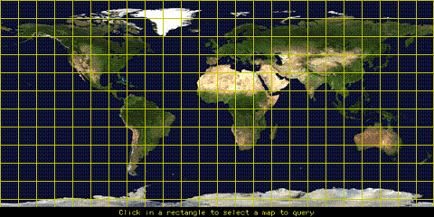
World Map: NASA free images: http://www.images.jsc.nasa.gov/
Continent Poem: http://teachers.net/gazetter/DECO2/continents.html
Continent Images: http:?/www.pics4learning.com
Links:
http://worldalmanacforkids.com
http://www.geographia.com
http://www.factmonster.com
Last
updated on August 15, 1999.
Based
on a template from The
WebQuest Page
|